

LOCATION AND DIRECTIONS
We are located on the Placencia Peninsula, in the Stann Creek District of Belize, Central America.
Our GPS coordinates are 16.583847, -88.363703 and we are approximately a 3-1/2 hour drive from the International Airport in Belize City.
The drive is very pretty, and ranges from orchards to mountains with some jungle and birds and everything in between. It gets dark by 6 pm in Belize so you want to coordinate your drive accordingly. There are not many streetlights and the road through the mountains is best driven during the daytime for maximum driving ease and pleasure.
Driving Directions
From Belize City Airport

Once you have your rental car (we recommend Jabiru at the airport), drive out of the airport road and when you get to the main road (the Northern Highway), turn left. You want to head towards Belmopan for the first half of your journey. Take the "Burrell Boom" cut . This will take you towards Burrell Boom, but it bypasses that village. There's no need to go into Burrell Boom. The road takes a slow curve towards Hattieville. This is where you will get onto the Western Highway heading south. The intersection has a traffic circle that looks like this:

Just after this roundabout, there is a building with the words "Dick Head" on the side

We always chuckle at this sign =)

Hattieville to Belmopan
You will soon see the sign for Belize Zoo and you will carry on towards Belmopan. You will see signs for the Coastal Highway. DO NOT TAKE THIS HIGHWAY. It is a dirt road, and if it has been raining, it can be very washboard or washed out. It's best to avoid this road entirely. It may look tempting, but we don't recommend it. Just past the coastal highway turn off is "Cheers" restaurant on the left. Decent food and cold beer, not exactly 'FAST FOOD' but the burgers and quesadillas were good.
DON'T GO DOWN THE COASTAL HIGHWAY:

Now that you have passed Cheers etc, you are heading to the next traffic circle show here in map view, then in satellite view.

Next, when you reach the outskirts of Belmopan, you will see the following traffic circle (roundabout). This one takes you towards Belmopan - you're only driving through the city and then onto the Hummingbird Highway. They have modified this circle slightly since this photo - it has curbs and pedestrian walkways etc now:

Don't go straight at the above roundabout. If you go straight, there's a bridge and a police station, and you will know you went too far. Instead, go 270 degrees to the LEFT as shown above towards Belmopan ....You are leaving the Western Highway and moving on to the Hummingbird highway at this point. Traffic signs and road signs are very sparse. As soon as you turn, there will be a park grounds on the right, for a farmer's market/Agro Fairgrounds... you'll see a sign for M&J Shopping on the left ... Caribbean Tire is also on the left ... There's a new traffic circle here, on the corner of Forest Drive and Hummingbird Highway - it has a big clock on it. Just go straight through this one:

Once you pass the above roundabout, there is an Uno gas station on your left ... Hummingbird furniture on the right ...
Then you'll come to the last BIG traffic circle which takes you out of Belmopan and towards the mountains...

You want to go around this white statue and continue on straight... (don't go left - that takes you back to Belmopan) ... You’ll be heading into the mountains now. There are LOTS OF SPEED BUMPS here and throughout. The next town you pass through is called Armenia. This is a twisty turny road but very pretty. You will note as you drive, when you are entering a village, there will be three rumble strips in a row and then a large Pedestrian Hump … the town or store or school itself, then another set of three rumble strips as you leave. Just remember to slow down for those big speed bumps. Your car’s undercarriage will thank you.
Just continue on this road until you reach the turnoff to Placencia shown on the map below. This part of the drive will take approximately an hour and a half. Eventually, there will be a Shell gas station on your right, and you make the next right turn onto the highway towards Placencia. If you go straight here, you will end up in Dangriga, so watch the signs!!

Continue straight past Silk Grass, Hopkins, the banana farm ... You will pass a Mayan statue and Mayan World adventure park on your right (it is lit up at night)
and then you're nearly at the last roundabout!!!

The last traffic circle of the trip looks like this:

YOU WILL TAKE A 270 TURN HERE TOWARDS PLACENCIA .... IF YOU COME TO A SIGN THAT SAY SANTA ROSA, THEN YOU WENT THE WRONG WAY ... . YOU'RE NOW ON THE LAST STRETCH OF THE DRIVE. YOU WILL PASS A SHRIMP FARM CALLED BAL (BELIZE AQUACULTURE) ... YOU WILL GO STRAIGHT NOW ... YOU'RE ALMOST THERE. You will come to a banana farm on the left, a community called Riverside … then you will see the Placencia Residences …
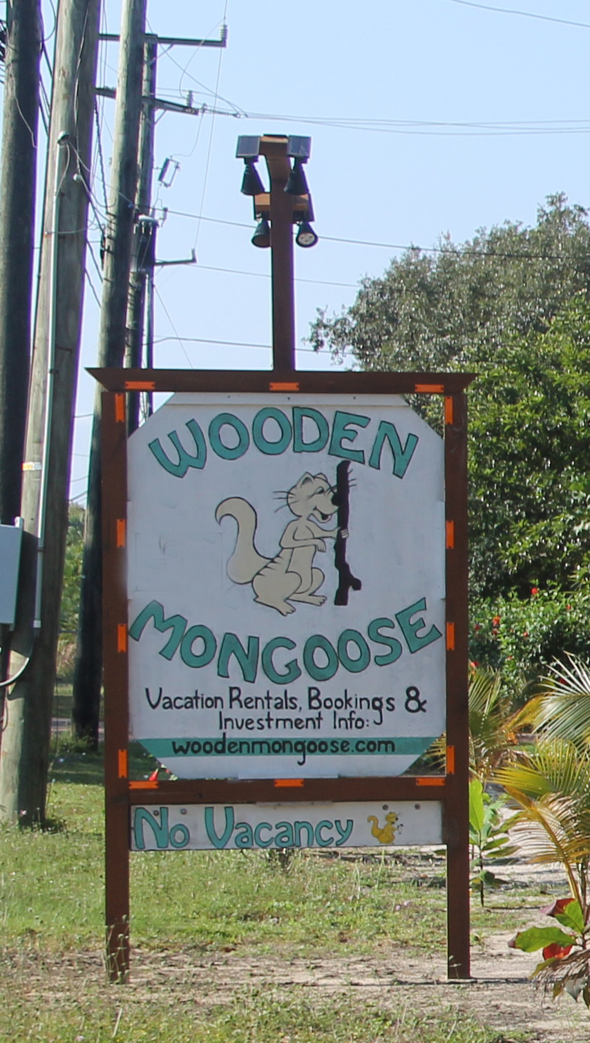
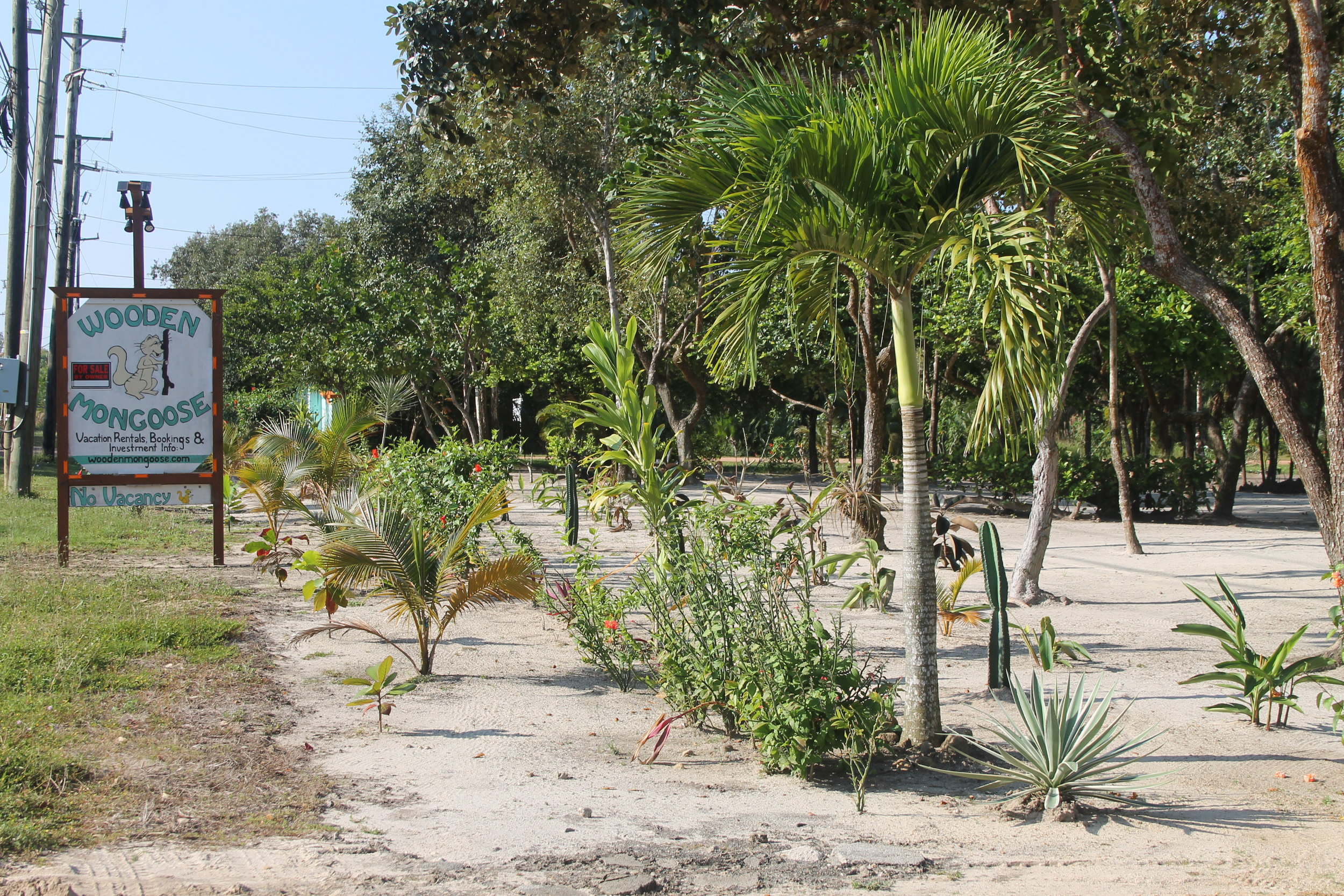
We are located at the 18 mile mark on the main Placencia Road on the Placencia Peninsula - known as the "Caye you can drive to" ... it is a long narrow peninsula with the Caribbean sea on one side and the lagoon on the other side. You will pass the Placencia Hotel and Casino on the left, Jaguar Lanes Bowling Alley on the right, and Naia Spa & Resort at Cocoplum on the left. YOU’RE ALMOST THERE! One minute past Naia/Cocoplum, you will see our Wooden Mongoose sign on the right hand side of the road. That is where your rental accommodation is located. We will have sent you a lock box code so you can access your house. Our manager will be along to get your information for registration for Belize Tourism Board, a mandatory form that we must have completed. That’s all there is to it! If you have questions, reach us at woodenmongoose@gmail.com.
CARIBBEAN SEA IS ON THE LEFT - LAGOON SIDE IS ON THE RIGHT
If you're arriving after dark, the sign looks like this:

If it is still daytime, it will look like this:
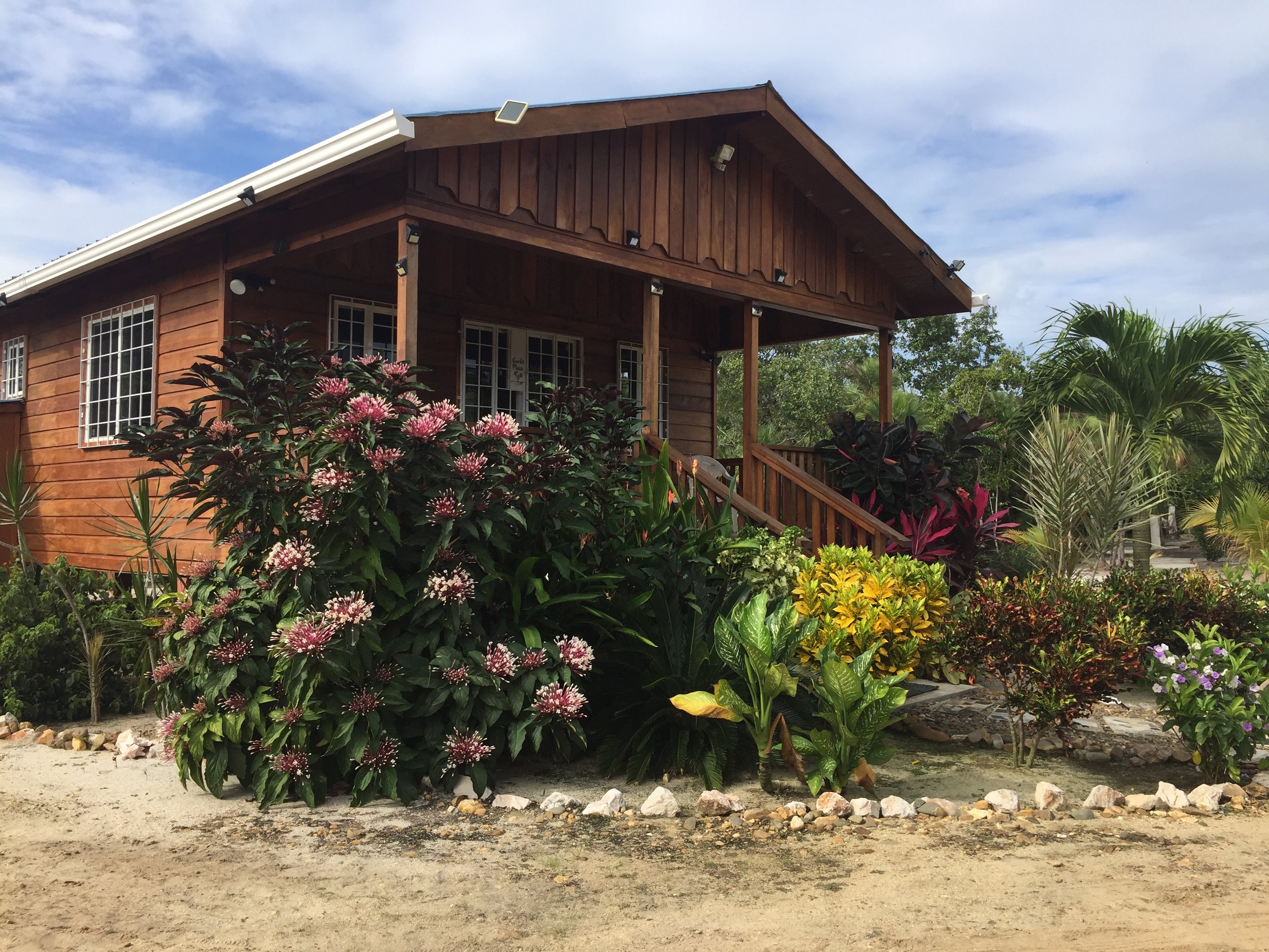
The Wooden Mongoose Sign and Entrance …. Your Cabin …
You will have had the code sent to you for the lock box. If you have any trouble please call us at 1-807-708-5869 (Canadian number)
If we happen to be in Belize at the time, we will greet you and give you the run down on locking the doors etc. YOU MADE IT
We're at 16 degrees latitude .... bring your sunscreen!
Directions from Placencia back to the airport in Belize City